The most critical days for Serbia are coming, and then... VIDEO
Meteorologist Djordje Djurić, hosted on the morning program "Jutro" on TV Prva, explained that it is not possible for two cyclones to collide over the Balkans.
Source: B92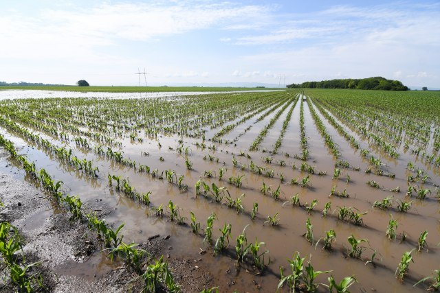
Let us remind you that yesterday there was information that two cyclones are moving towards each other and will collide right over the Balkans.
As said, one cyclone is supposed to bring us showers even more abundant than the ones that are already hitting us. While the other brings even greater heat and fume.
Djurić said that he thinks it is a mistake, and that it is not possible in meteorology.
"You must have meant an anticyclone, a completely opposite system that cannot collide, but can overcome each other. So, in the previous days, we were all the time under the influence of a high-altitude cyclone that brought this unfortunately unstable weather, very abundant showers, strong thunderstorms and floods. Yesterday there was a short-term stabilization that will continue throughout today, and already tonight there will be new cloud cover, a new impact of the cyclone that will last until the end of this week with a new wave of precipitation."
Djurić explained that the showers that hit Serbia were very unevenly distributed.
"This means that their intensity was quite different. So, in one location, we had precipitation in an hour, two times as much as it falls in a month. And only a few kilometers away, there was not even a drop of rain."
He also explained that the cyclone arriving in Serbia will bring precipitation that will be a little more evenly distributed.
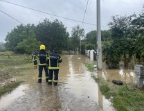
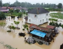
"Again, unfortunately, more abundant amounts are expected. Not like now that we had in the previous days. But now there is one bad news. The land is already soaked with a large amount of water. Which was not the case before this rainfall. So, the rivers are already fully swollen. When we talk about rivers, I mean these small and medium-sized streams. Every additional rain represents a new danger. First of all, smaller torrential streams," said Djurić.
When asked what exactly that means, and whether it is possible that we will have reports on floods during the next week, Djurić answered:
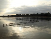
"Well, not the next one, but unfortunately from tomorrow. Thursday, Friday, Saturday are the most critical as it is. Especially in the southern and eastern parts of the country. Again, we are talking about smaller, very small rivers and streams. Which under normal circumstances are only a few tens of centimeters high. And when of very heavy rainfall, they can rise by several meters in just a few hours and cause great damage. They also return to their beds very quickly. And when it comes to larger rivers like the Sava and the Danube, there is no danger. Even after that big increase, we had a significant drop. In the following period, the Sava and Danube will rise again. But without reaching critical values and the danger of floods".
Djurić said that the temperature will drop again from tomorrow, and that it will be around 20 degrees".
Djuric explained that from Monday "finally the real June, and therefore the real summer weather" will arrive.
"Summer is coming, it seems to me, in exactly one week. That's how it will coincide. It is this cyclone that will bring us, therefore, unstable weather with precipitation, it is weakening since Sunday and from next Monday the influence of the anticyclone is getting stronger, so, of a high air pressure system that will come to us from the southwest of Europe and for the first time this year will bring, let's say, real summer weather".