The new "Vožd Karađorđe" highway route
Topola -- Village of Maskar near Topola, according to the locals, is the testing ground for the future highway "Vožd Karađorđe" route.
Source: RINA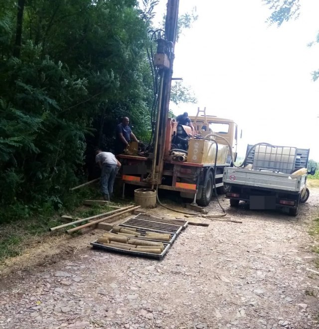
The locals point out that the machines were in their village for several days, and that the construction workers present told them that they plan to test the soil hardness.
"These tests have been going on for two, almost three months. The engineers were in Maskar, on the stretch below the cemetery, namely, the tests were carried out across the street from the cemetery, and below my household, 130 meters from my house. I have to tell you that I don't mind the works at all, but there is some fear, about three hectares of my land are threatened, I have fields, prohibitions, and the house is close by. We know that the highway will be built, but where exactly it will pass and what will happen to our households and fields, no one tells us, Ivan Nikolić told RINU.
Mr. Nikolić adds that the workers who performed the soil tests said that they started their work at Markovac and will finish in Lazarevac, which would cover about 180 kilometers of the route.
By the way, the Corridors of Serbia website, stated that the construction project of this highway includes the territories of the municipalities: Sopot, Mladenovac, Lazarevac, Aranđelovac, Topola, Rača, Lapovo, Velika Plana, Svilajnac, Despotovac and Bor, all part of Šumadija, Pomerania, and Bor district.
As written on the website of the Corridor of Serbia, the state road of the first order "Vožd Karađorđe" should include the following sections:
Section 1: Lazarevac (Županjac) - Arandjelovac L= 35 km.
Proposal in accordance with PPO Lazarevac, , PPO Aranđelovac (Planned detour),
Section 2: Mali Požarevac – Mladenovac – Aranđelovac L= 32 km.
Proposal according to PPO Sopot, PPO Mladenovac, PPO Aranđelovac
Section 3: Arandjelovac – Topola – Rača – Markovac (connection to highway E-75) L= 60 km
Proposal according to RPPS - Regional Spatial Plan of Serbia
Section 4: Markovac – Svilajnac – Despotovac L= 31 km
Proposal according to RPPS - Regional Spatial Plan of Serbia
Section 5: Despotovac - Bor L= 60 km
Proposal according to PPO Despotovac, RPP - Regional Spatial Plan of Serbia, PPO Bor